Officials and staff of Republic of Indonesia's Ministry of Agrarian Affairs and Spatial Planning/National Land Agency or Kementerian Agraria Dan Tata Ruang/Badan Pertanahan Nasional (ATR/BPN) and specialists from Land and Governance Innovations and Consultants, Inc. (LGI Consultants) visited NAMRIA Fort Andres Bonifacio, Taguig City on 23 May 2023. The delegation was headed by Ms. Andi Tenri Abeng, Head of the Regional Office of the National Land Agency for West Kalimantan Province. She was accompanied by Ms. Ana Anida, Head of Sub-Directorate of Land and Spatial Management; Ms. Maria Iriana Puji Lestari, Head of Planning Department; Mr. Langlang Tresna Permagati, Young Land Arranger at the Directorate of Land and Spatial Registration Arrangements; Mr. Angga Putra Perdana, Information System and Network Analyst; and the group from LGI Consultants. The main purpose of their visit to NAMRIA was to learn about the Philippines' National Spatial Data Infrastructure (NSDI) and other key spatial datasets.
On behalf of NAMRIA Administrator, Usec. Peter N. Tiangco, PhD, OIC-Deputy Administrator (DA) Ofelia T. Castro welcomed all the visitors. She headed the NAMRIA panel composed of the following executives: Geospatial Information System Management Branch (GISMB) Director (Dir.) Febrina E. Damaso and OIC-Assistant Director (Adir.) Arlene B. Brillantes; Hydrography Branch (HB) OIC-Dir., Capt. Antonio G. Valenzuela, Jr.; Mapping and Geodesy Branch (MGB) Dir. Ruel DM. Belen and OIC-Adir. Brian A. Dela Cruz; and Resource Data Analysis Branch (RDAB) OIC-Dir. Benjamin P. Balais. Other officials present were Geospatial Database Management Division (GDMD)-GISMB Chief Rosal H. Dolanas, Policy and Planning Division-Support Services Branch (SSB) Chief Xenia R. Andres, and Geospatial Systems Development Division-GISMB's Information System Analyst Melvin O. Perez.
The showing of the audio-visual presentation (AVP) of the agency profile was done after the self-introductions made by everyone present. The AVP features the agency's mandate, mission/vision, core functions, technical branches, products and services, and accomplishments through the years.
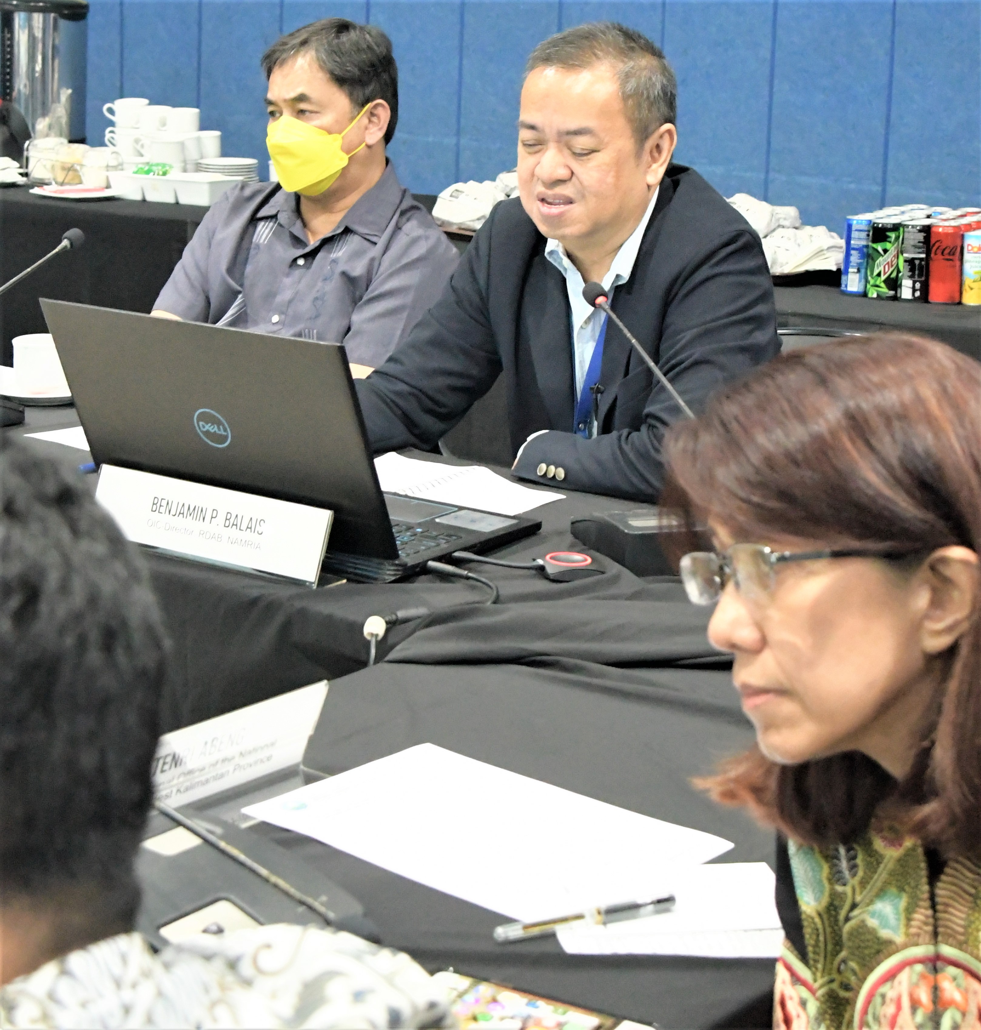
Officer in Charge (OIC)-Dir. Balais discussed comprehensively the NSDI, from its conception in the 1990s up to its current status. He said that the NSDI seeks to establish an Internet-based geographic information system in the Philippines. He described the system as where interested users in the government, private sector, and even the general public can have ready access to various types of geographic data, e.g., topographic base maps, thematic maps, and other kinds of maps, and geodetic control point coordinates.
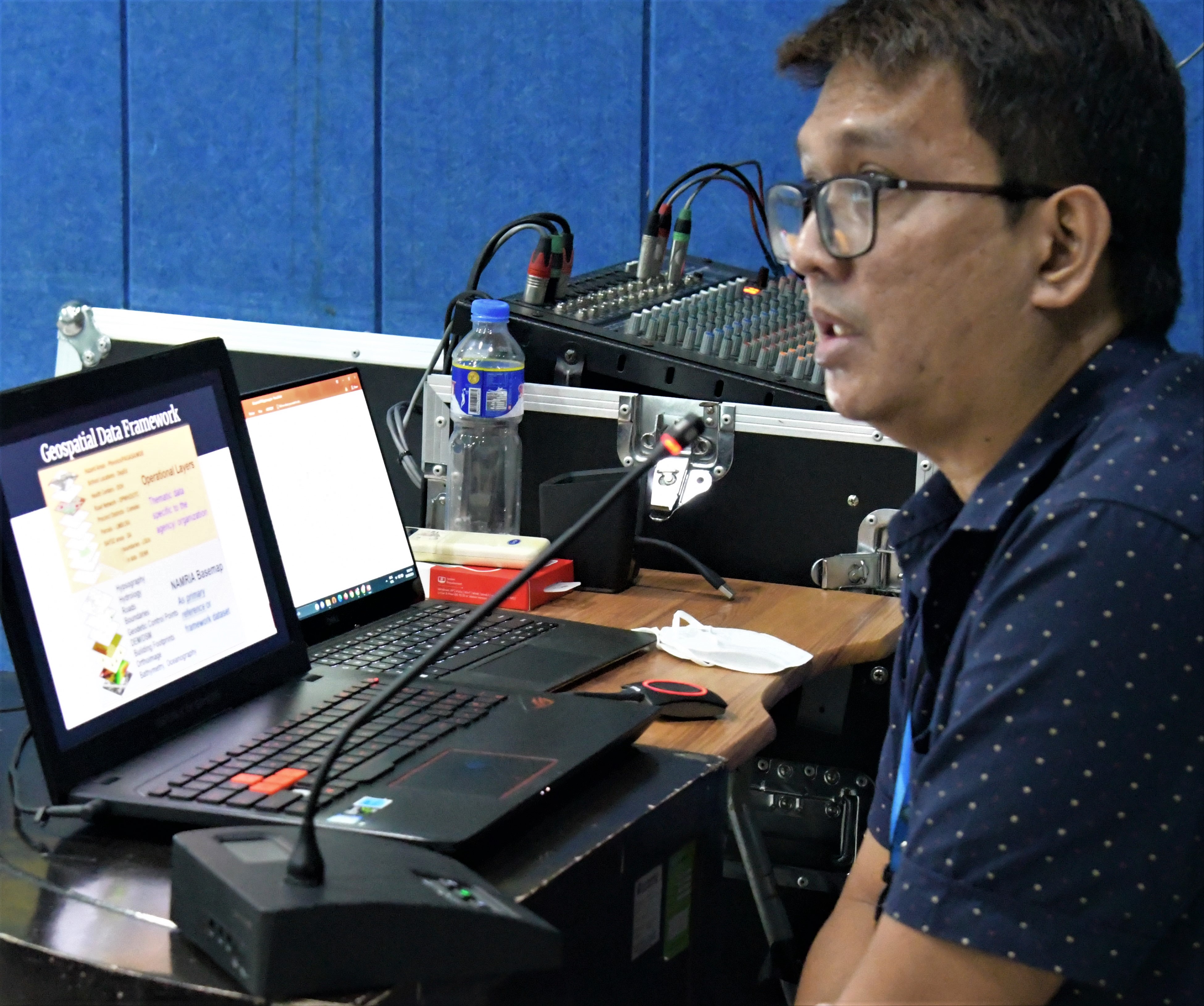
Geoportal Philippines (GP) is a brainchild of the NSDI and it advocates the use of standard multi-scale base maps that serve as tools for strategic planning, decision making, situational analysis, and other common uses. For a better appreciation of the GP, Mr. Perez did a brief presentation and demonstration on how to access and use its map applications.
An open discussion was held after the presentations. OIC-DA Castro, MGB Dir. Belen, GISMB OIC-Adir. Brillantes, GDMD-GISMB Chief Dolanas, and Mr. Perez answered the queries of the visitors. The information given included there being 60 stakeholders (national government agencies, local government units, and state universities and colleges) that already shared their respective data through the GP. These stakeholders also have data sharing agreements with NAMRIA.
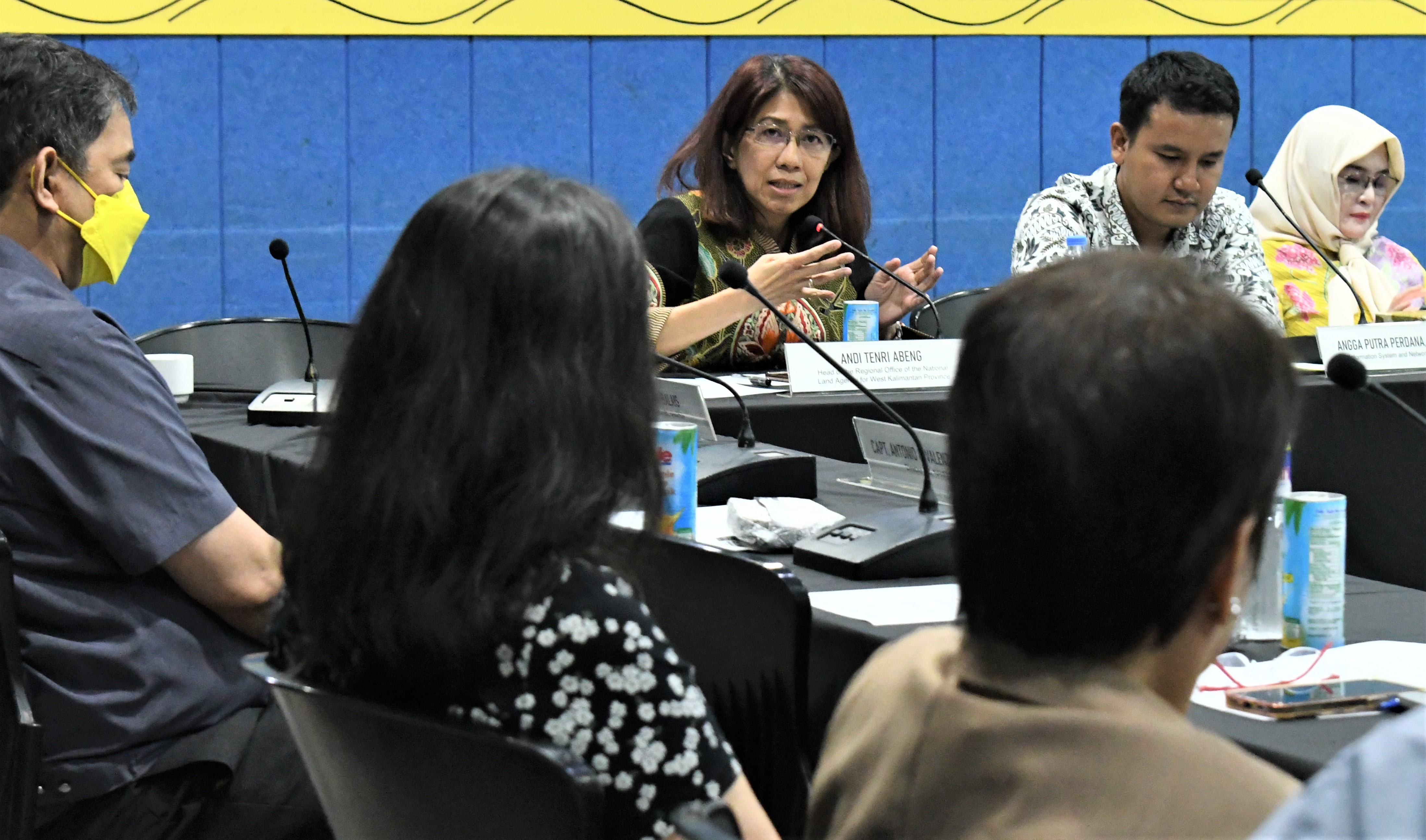
The discussions ended with Ms. Abeng's conveying her expression of appreciation to NAMRIA. Her message, in Bahasa Indonesia and later translated to English by Mr. Perdana, focused on her admiration of NAMRIA's capabilities and technological advancements in mapping. She also invited NAMRIA to visit their country soon. OIC-DA Castro acknowledged their gratitude and encouraged them to visit other historical and tourism spots within Metro Manila.
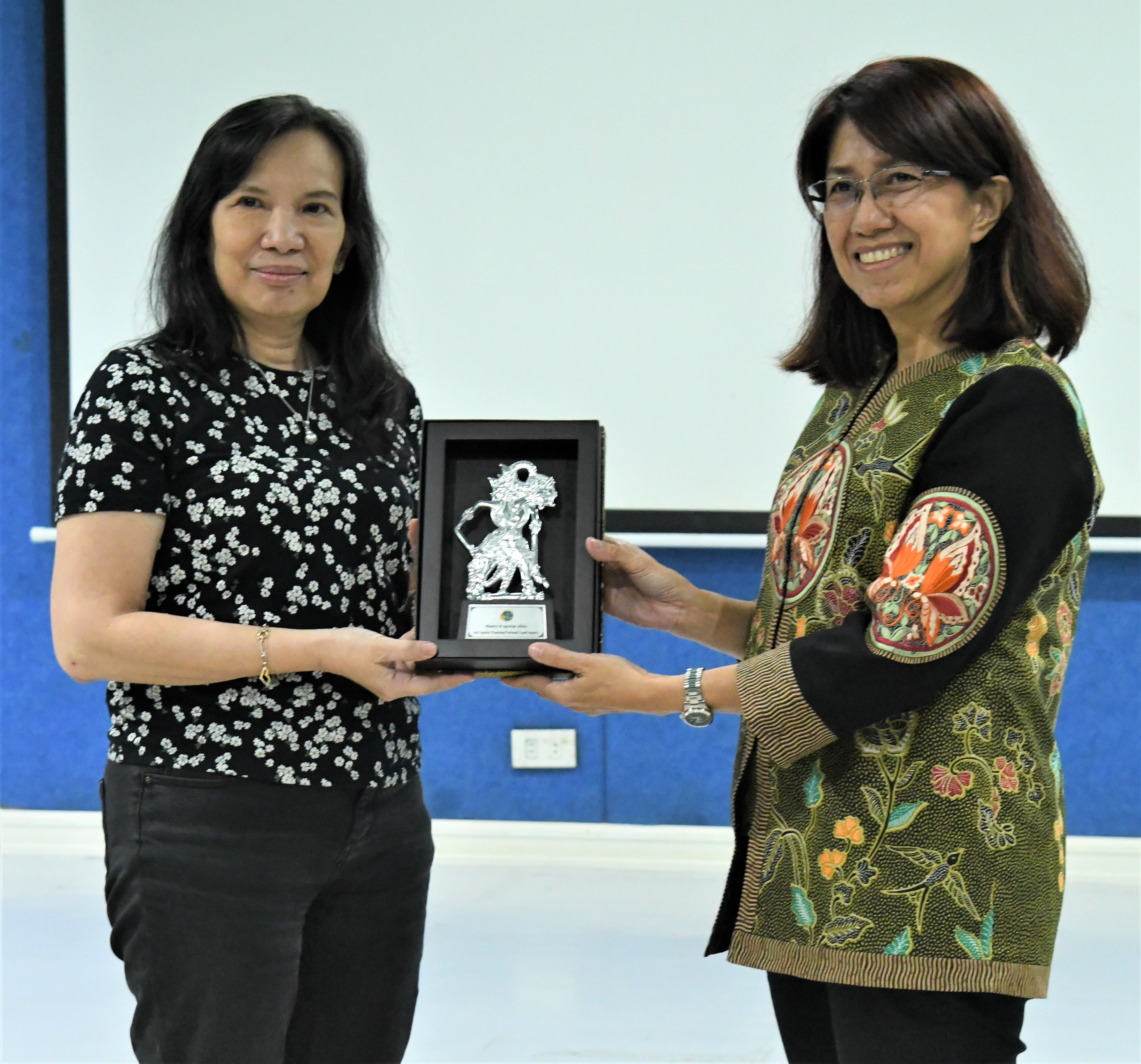
The program closed with the awarding of ATR/BPN's token of appreciation to NAMRIA, which was received by OIC-DA Castro. The token bears their office name and features a metallic puppet, famously known to them as Wayang. Staff from Geospatial Information Services Division-GISMB and Engineering Services Division-SSB provided documentation and logistics support.
RDAB OIC-Director Balais (top photo) and Mr. Perez (bottom photo) discuss their respective topics. –VENER QUINTIN C. TAGUBA, JR.
Mr. Perdana poses a question during the open discussion part of the program. –VENER QUINTIN C. TAGUBA, JR.
Ms. Abeng expresses her appreciation for the knowledge shared by NAMRIA during the visit. –VENER QUINTIN C. TAGUBA, JR.
Ms. Abeng gives OIC-DA Castro the "Wayang." –VENER QUINTIN C. TAGUBA, JR.
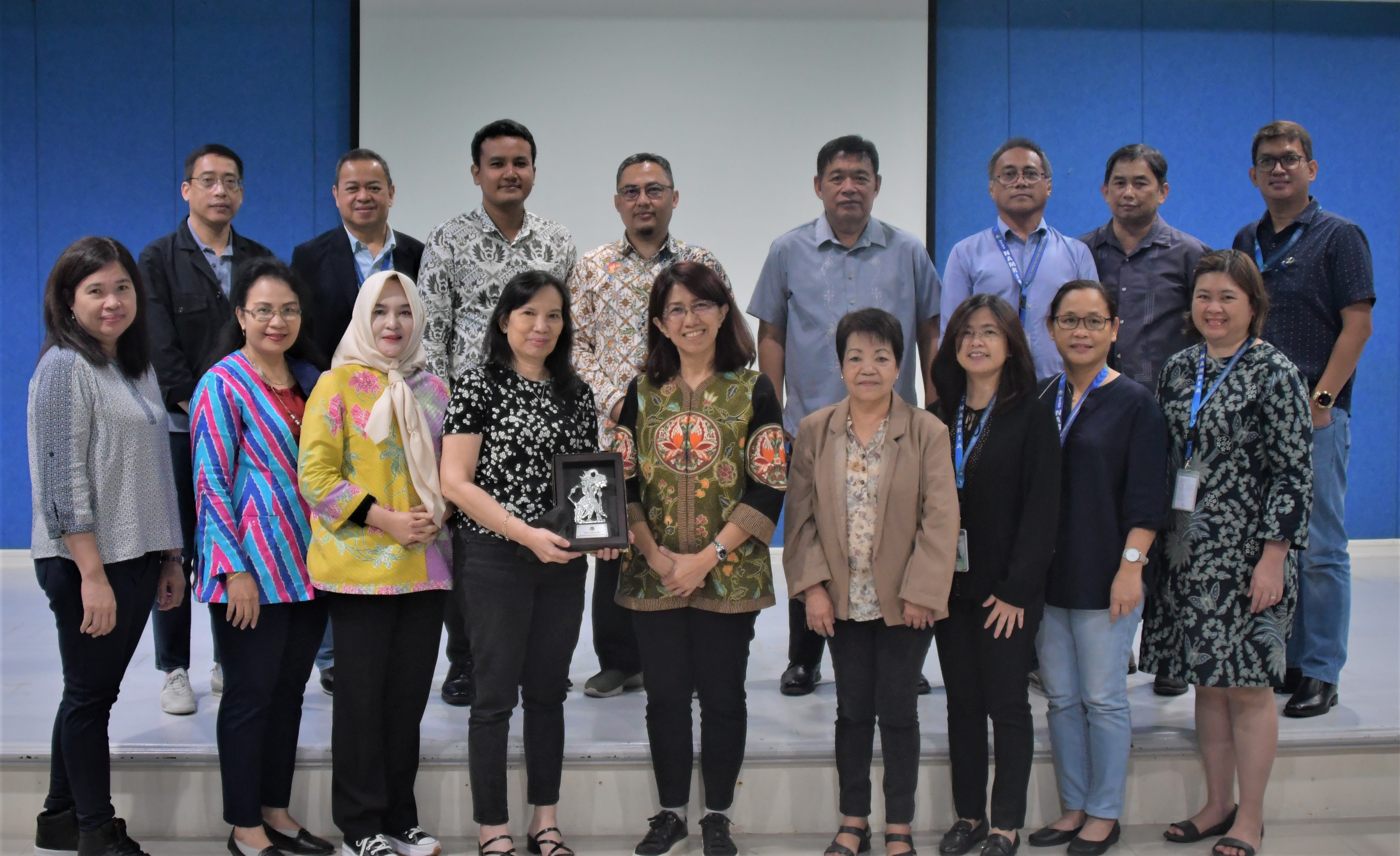
The ATR/BPN delegates, NAMRIA contingent, and LGI Consultants specialists pose for a souvenir photo after the program. –ERWIN D. FAMATIGA
Readers can email
newscoop@namria.gov.ph or fax letters to +63-2 8884-2855 for their comments and suggestions.
 SHOP
SHOP


 LOCATE
 DOWNLOAD
 LEARN
LEARN