 |
|
|||||||||||||
Home > Activities |
| news and events | |
| regional updates | |
| regional accomplishments |
A workshop on the establishment of the NAMRIA spatial data infrastructure (nSDI) was held at the NAMRIA Lecture Hall last 18 August with participants from the agency’s various departments, most of whom attended the Strengthening NAMRIA Middle-Management Leadership training. The workshop was spearheaded by the ad hoc technical working groups (TWGs) on institutional framework, fundamental datasets and standards, and clearinghouse network.
The workshop intended to (1) discuss and determine the appropriate policies governing the nSDI; (2) identify and determine the appropriate data exchange format standards; (3) evaluate and finalize the list of the initially identified fundamental nSDI datasets, including the suitable nSDI clearinghouse network; and (4) identify the financial requirements and the possible funding sources for the nSDI implementation.
The nSDI is an infrastructure that will facilitate the gathering, storage, and distribution of spatial data across NAMRIA. It is an offshoot of the NAMRIA-Geoscience Australia memorandum of understanding (MOU) signed in August 2009 to strengthen spatial data development and delivery in the Philippines. The MOU stipulated the provision of technical assistance in the development of an internal spatial data infrastructure or NAMRIA SDI (nSDI) strategic and implementation plan; the improvement of data validation systems; and the piloting of a small 1:50,000 topographic data spatial database and a simple Intranet web-map interface for it.
The nSDI general objective is to build effective and efficient spatial data management processes within NAMRIA. Specifically, the infrastructure is aiming for an increased access to up-to-date authoritative data across NAMRIA; improved spatial data management processes; increased spatial/GIS staff skill; and improved client and customer data supply and services. The nSDI would help NAMRIA in advancing the national SDI or NSDI, a network of digital databases located throughout the Philippines which collectively will provide the fundamental data needed for socioeconomic, human resource, and environmental development objectives.
In her welcome remarks, Deputy Administrator for Information Management and Mapping Linda SD. Papa said that everyone has a role and a stake in the implementation of the nSDI and that the roadmap to the NSDI has been prepared. “The nSDI development and implementation departmental plans formulated during the leadership training must be put into action,” she added.
The workshop presenters and their topics were Database Management Division Officer In Charge (OIC) Benjamin P. Balais, project briefing; Information Management Department (IMD) OIC Adir. Febrina E. Damaso, workshop mechanics; Mr. Joselito T. Reasol, proposed institutional framework; Ms. Arlene B. Brillantes, Mr. Magellan C. Azucena, and Mr. Angelo T. Arboleda, proposed clearinghouse network; Forester Alma SM. Arquero, Cdr. Ronaldo C. Gatchalian, and Cdr. Rosalino C. Delos Reyes, fundamental dataset workshop outputs; and Mr. Jaime P. Mallare, summary of workshop proceedings. IMD OIC Director John SF. Fabic and OIC Adir. Damaso served as open forum moderator and master of ceremony, respectively.
In closing, Deputy Administrator for Remote Sensing and Hydrography Efren P. Carandang congratulated the TWGs for the conduct of a “very important, very enlightening, and very productive” workshop. He said, “there is a multitude of data that NAMRIA can provide to the public” and “we just need to organize them through a program like the nSDI.” He also expressed optimism on the implementation of the nSDI and its being the trailblazing legacy of NAMRIA employees.Station Balanacan to be named as national landmark
The Interagency Task Group Balanacan spearheaded by Deputy Administrator Linda SD. Papa presented the Station Balanacan preservation initiatives to the Marinduque Provincial Government on 16 August 2010. The interagency task group is composed of representatives from NAMRIA and the Region IV-B office of DENR. The group works with local government units, regional line agencies, and the National Historical Commission of the Philippines (NHCP) in carrying out its initiatives.
The presentation held at the session hall of the provincial capitol in Boac was attended by the members of the provincial interagency committee led by Governor Carmencita O. Reyes. The preservation initiatives are the (1) Declaration of the Station Balanacan, Luzon Datum Origin as National Historical Landmark; (2) Issuance of a Presidential Proclamation reserving a parcel of public land as the site of the Luzon Datum Origin National Landmark; and (3) Site Development of the Luzon Datum Origin National Historical Landmark.
The initiatives aim to give importance to Station Balanacan in the history of Philippine surveying and mapping; to develop the station as a domestic tourism site in order to ensure stewardship for its maintenance and protection; and to create a high impact in the drive to generate awareness among the various stakeholders and their support to the Adopt-a-Mojon program of the Philippine Reference System of 1992 project.
The NHCP has issued a certification recognizing the national significance of Station Balanacan. In addition, it has granted the installation at the station of a national historical marker that will be installed on a date in time for the centenary of the establishment of the Luzon Datum. Moreover, activities are under way to expedite the technical and complete staff work for the presidential proclamation reserving a parcel of public land as site of the Luzon Datum Station Balanacan national landmark.Program Review and Analysis conducted for PRS92
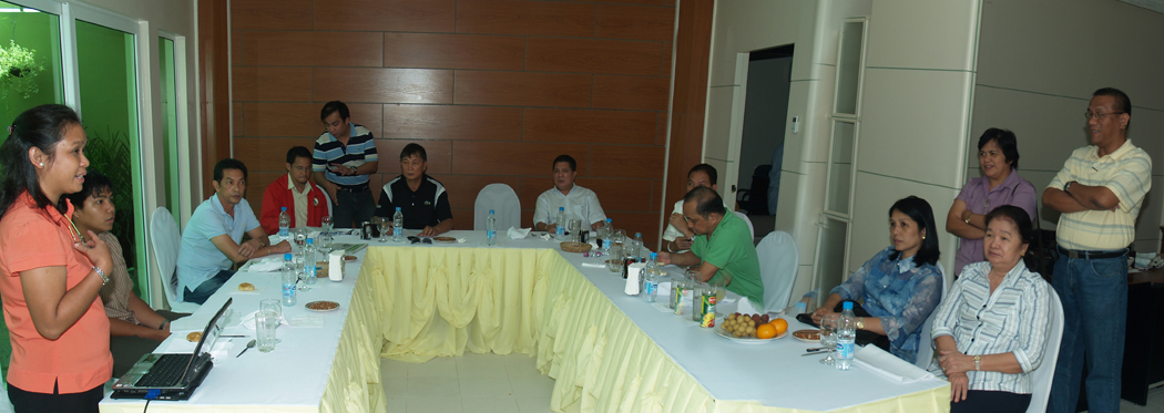
NAMRIA hosted the PRS92 Program Review and Analysis (PRA) for Luzon on 07-08 April 2010 and for Visayas and Mindanao on 22-23 April 2010 at the NAMRIA Lecture Hall in Fort Bonifacio, Taguig City. The meeting gathered the respective DENR Regional Technical Director (RTD) for Lands, Chief of the Regional Surveys Division (RSD), and Chief of the Field Network Survey Party (FNSP) along with NAMRIA PRS92 component heads and members to discuss the status and direction of the PRS92 regional implementation.
In his welcome remarks, NAMRIA Administrator Peter N. Tiangco urged all those concerned to take on the challenge of achieving the regional targets of the PRS92 project and assured them of NAMRIA’s continued support. NAMRIA Deputy Administrator (DA) Linda SD. Papa expressed her wish for the participants’ productive discussions on their PRS92 regional accomplishments, financial reports, and other issues arising from the project implementation. In turn, DA Efren P. Carandang emphasized the importance of the forum as a venue for discussing issues and concerns and coming up with recommendations for solutions.
In both events, Mr. Nicandro P. Parayno, Officer in Charge of the NAMRIA Aerial and Spatial Surveys Division, presented the updates on the regional accomplishments for Cadastral Data Transformation and Integration activities. NAMRIA Geodesy and Geophysics Division Chief, LCDR Ronaldo C. Gatchalian reported on the status of the densification from 2007 to the present time of fourth-order geodetic control points (GCPs) in the country. He also reported on the status of the Geodetic Network Information System (GNIS), the Land Survey Database Management System (LSDMS), and the Adopt-a-Mojon Program.
The regional participants were allowed to validate the data presented after each presentation. The respective regions later presented their accomplishments and remedial or catch-up plans for 2007 and 2008 slippages. The completion and submission of 2007-2008 targets and of the report of liquidation of funds were set as conditions for the release of funds to the regions to implement their project activities in the current year.
Other implementation arrangements were, but not limited to: NAMRIA will recommend a policy that will authorize an LMS to issue certification of ground control points in its region, setting a standard fee and designating the approving authority; during the meeting, the RTD for lands was identified as the signatory. NAMRIA will certify LMS personnel who will demonstrate the capability to process and evaluate GPS data that was expected of the LMS since 2008. To qualify, LMS personnel shall submit their work for assessment to the Geodesy and Geophysics Division of the Mapping and Geodesy Department which will issue the Certificate of Competence to qualified personnel and to the LMS concerned. The LMS’s were advised to back up all their data holdings to prevent loss and urged to populate their Regional Geodetic Network Information System (RGNIS), furnishing NAMRIA copy of all data entries. The use of cadastral lot corners as old reference points for the determination of transofmation parameters was agreed upon; provided that the integrity of said corners is ascertained by the LMS using them.
Representatives of the Land Management Bureau also attended the PRA and presented their accomplishments. Among the responsibilities of NAMRIA on the PRS92 Project is the monitoring of the densification activities of the LMS and the compliance to the regional catch-up plans.

 Regional Updates
 08.18.2007 GNIS component trains regional offices
In support of the development, implementation, and enhancement of the Geodetic Network Information System (GNIS), and the Land Survey Database Management System (LSDMS), the GNIS component conducted technical retrainings on the enhanced systems for its users in the DENR regional offices. Aside from users retraining, other activites included the installation of updated GNIS and LSDMS; database updating; discussion on LSDMS importing; and hands-on importing of cadastral project stored in MS Excel files to LSDMS.
The GNIS component technical staff conducted the retraining in Manila on 22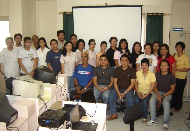 July for Regions IV-A and IV-B; in Pampanga on 24-25 July for Region III; in La Union on 27-30 July for Region I; in Baguio City on 30 July-02 August for the Cordillera Administrative Region; in Tuguegarao City on 12-15 August for Region II; in Legazpi City on 31 July-02 August for Region V; in Butuan City, Tacloban City, and South Cotabato on 03-06 August for CARAGA and Regions VIII and XII; in Iloilo, Cagayan de Oro City, and Davao City on 10-13 August for Regions VI, X, and XI; and in Cebu City on 13-16 August for Region VII. The trainings aimed to enhance the skills of the regional staff in the performance of their assigned tasks in the implementation of the PRS92 project.
07.14.2008 LGUs oriented on PRS92
 The PRS92 project was presented to the local government officials and staff of the city of Antipolo and the municipal mayors of the provinces of Aurora and Bataan in separate occasions. The main objectives of the IEC activity were to inform the local executives on the PRS92 activities and secure their cooperation to ensure the safety of the survey teams in the recovery survey conducted by NAMRIA in their locality. NAMRIA targeted this year to recover at least 10 GCPs (Bureau of Lands Location Monuments, Municipal Boundary Monuments, and Barangay Boundary Monuments) for the concerned areas. This is necessary for the integration and data transformation into PRS92 of their old surveys and maps.
The LGUs were also introduced to the Adopt-a-Mojon Project which is a nationwide DENR-NAMRIA initiative for the sustainable utilization of the PRS92 through the adoption of its GCPs. It enlists the participation of the stakeholders to preserve and protect the PRS92 GCPs marked by “mojons” and advocates the significance of GCPs to resource management and landadministration.
The IEC in Antipolo City was conducted on 10 Jul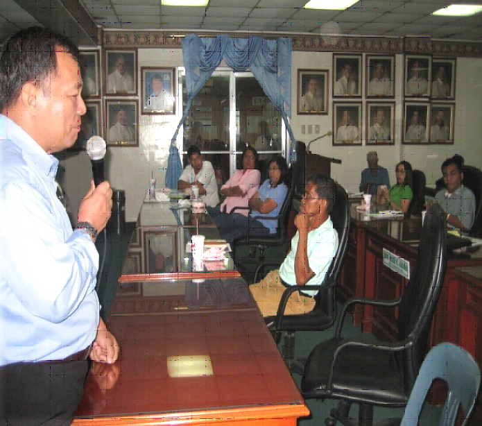 y 2008 at the city hall. ThePRS92 presentation was conducted during the special meeting of the Mayors League of Aurora on 21 July 2008 in Baler, and during the regular meeting of the Mayors League of Bataan on 29 July 2008 in Abucay.
01.17.2008 Mexico, Pampanga adopts mojons
The municipality of Mexico, Pampanga represented by Mayor Teddy Tumang 
 and the DENR represented by DENR Regional Executive Director Regidor De Leon signed a Memorandum of Agreement (MOA) to adopt mojons in their locality last 16 January 2008.
The municipality of Mexico was among the first municipalities in Pampanga to support the PRS92 project. The DENR Region 3 has completed the recovery of old geodetic control points or mojons in the area. The coordination for the adoption of mojons was done last year by the DENR regional office and NAMRIA with the office of the mayor through his representative, Head Executive Assistant Engr. Jesus Punzalan.
GEODETIC NETWORK DEVELOPMENT
(May 2011)
NAMRIA is spearheading the establishment of the Philippine Active Geodetic Network (AGN) as part of the implementation of the PRS92 Project. As envisioned, the AGN will be composed of stations strategically located all over the country which continuously provide geographic data. To date, all six Active Geodetic Stations (AGS) have already been set up: four are roof-based (NAMRIA Main Building in Taguig, Urdaneta City Hall in Pangasinan, Registry of Deeds Building in Tagaytay, and Basa Air Base in Floridablanca, Pampanga) while two are ground-based (Nueva Ecija University of Science and Technology in Cabanatuan City and 415th Police Provincial Mobile Group in Candelaria, Quezon). All six are ready for interconnection to the network. For the Data and Control Center (DCC), the installation of the Center’s ICT requirements has been completed. Support systems needed in the operation and maintenance of the DCC, such as fire suppression and access control systems, have already been configured and tested. |
DENSIFICATION OF GCPs by NAMRIA
(as of May 2011)
Horizontal Control Network
Vertical Control Network
Zero Order Network About 65 first-order GCPs were recovered and observed from 2009 until June 2010. Processing and adjustments of GCPs using the Active Geodetic Station (AGS) –PageNET in Taguig City as reference control were finished in July 2010. These zero-order points are now available for use as reference points in geodynamic studies. Ongoing projects: First-order GCP re-observation Inter-island benchmark connections Nine clusters of benchmarks in loops were recovered and observed using the Global Positioning System to determine the relationships of the Mean Sea Levels (MSL) of the major islands in the Philippines to the National Vertical Datum. As of May 2011, all of the nine clusters of benchmarks in loops were observed, processed and MSL relationships observed. Gravity Network Some 80 first-order gravity stations will be established nationwide for scientific applications and for the formulation of a Philippine geoid model. As of May 2011, established are 80 first-order and 68 second-order gravity stations.Benchmark connections to GCPs Around 5,000 kms. of level line will be surveyed to connect the GCPs to the existing benchmarks to compute the Geoid undulations. The activity is essential in the computation of the Geoid model of the Philippines. The project is ongoing. |
Established Tide Stations
Total no. of tide stations established (as of May 2011) |
47 |
Claveria tide station is for relocation due to erosion and environmental conditions.
TRANSFORMATION AND INTEGRATION
The NAMRIA PRS92 Data Integration Task Group continued to undertakethe quality control of cadastral datasets for Ilocos province-Region I and the National Capital Region (NCR). All plotted lots are currently being converted from local to grid coordinates. In compliance with the agreements reached during the PRS92 Coordinating Conference held on 18 April 2011, the Task Group conducted a retraining program and lecture on the derivation of local transformation parameters of Regions III, VII, VIII, IX, and XIII. This is also in pursuance of the commitment of NAMRIA to Provide relevant technical assistance and support for the full adoption of PRS92 and enhancement on the capability of the regional offices. On the other hand, the surveying arm of the Task Group is presently establishing image control points (ICPs) at the northern portion of Bohol province. Said ICPs will be used for the transformation of satellite imageries into PRS92. A total of 48 ICPs for four map sheets covering the Province of Bohol is set to be established. Similarly, a total of 70 photo control points (PCPs) were established in the Province of Aklan. Additional 12 PCPs were established in Casiguran, Aurora. At present, the processing of Global Positioning Systems (GPS) raw data and of PCP Description Sheets was finished and they are ready for submission. A total of 161 PCPs covering Casiguran, Eastern Laguna de Bay, North Western Panay, and Pampanga is set to be established for use in the large scale topographic base mapping under the PRS92 project. |
GEODETIC NETWORK INFORMATION SYSTEM
There are three developed systems currently installed in 18 regions of the country. These are the regional Geodetic Network Information System (GNIS), the Land Survey Data Management System (LSDMS), and the Metadata Entry for environment and natural resources datasets. As of May 2011, Regions 1,2,5,7,8,11, and CAR were visited for the update of regional GNIS and LSDMS, and installation of the 4-parameter derivation program and online synchronization module of both systems. |
ALL REGIONS (Data Integration Component) |
||||||||||||||||||||||||||||||||||||||||||||||||||||||||||||||||||||||||||||||||||||||||||||||||||||||||||||||||||||||||
|
||||||||||||||||||||||||||||||||||||||||||||||||||||||||||||||||||||||||||||||||||||||||||||||||||||||||||||||||||||||||