 |
|
|||||||||||||
Home > About PRS92 |
| significance to national development | |
| stakeholders and beneficiaries | |
| legal basis for implementation | |
| implementors of EO 321 | |
| how is PRS92 implemented | |
| future plans of the program |
 What is PRS92?
PRS92 or the Philippine Reference System of 1992 is a homogeneous national network of geodetic control points (GCPs), marked by survey monuments or mojons, that has been established using Global Positioning System (GPS) technology. GPS is an all-weather, high precision, global satellite positioning system that revolutionized navigation and surveying operations.
By virtue of EO 45, PRS92 became the standard
reference system for all surveying and mapping
activities in the Philippines. The order also mandated
that all new surveys and maps shall be referred to
the new network and all old surveys shall be
integrated into it.
Significance of PRS92
PRS92 serves as the country's standard coordinate reference system for all survey and mapping activities.
It provides the means through which base and thematic datasets can be consistently inter-related geographically.
PRS92 is the fundamental component of the National Spatial Data Infrastructure (NSDI).
Who are the stakeholders and
beneficiaries of PRS92?
The primary stakeholders of PRS92 are all
government agencies engaged in surveying and
mapping like the DENR, the Department of
Agriculture, the Department of National Defense,
the Department of Public Works and Highways, the
Department of Transportation and
Communications, the Department of Agrarian
Reform, the National Commission on Indigenous
Peoples, and other agencies having interest in
mapping.
Private surveyors, foresters, and academic
institutions are also major users. Private and public
landowners and fisherfolks are the major
beneficiaries while the general public that is
benefiting from the programs of the mentioned
government agencies is the indirect beneficiary.
What are the legal basis for the
implementation of PRS92?
PRS92 was first implemented through EO 45
under the Ramos Administration. Subsequently, it
was amended by EO 280 extending its full
implementation by 2005. In order to complete the
adoption and integration of old surveys into the
system until year 2010, EO 321 was issued by
President Gloria Macapagal-Arroyo.
Who are tasked to implement EO 321?
The DENR, through the PRS92 Program
Steering Committee, oversees the overall
implementation of EO 321, allocates the necessary
funds, and issues implementing guidelines. The
NAMRIA, Lands Management Bureau and the
DENR Regional Operations Committees are the
primary agencies responsible in executing the
Order.
How is PRS92 implemented?
The NAMRIA establishes and maintains the
primary (first and second-order) control points,
which are then densified by the DENR Regional
Composite Survey Teams by establishing third,
fourth and other lower-order control points. Using
a transformation formula, these and previously
established control points are integrated into the
PRS92 network. All existing surveys and maps of the DENR are also being integrated into the system.
The ultimate objective of the program is for all
surveys and maps in the country to be compliant
with the PRS92 standards.
DENR Administrative Order No. 2005-13
provides the overall guidelines in the implementation
of the PRS92 program.
What are the future plans of the PRS92
program?
To provide better user access to geodetic network
information, the DENR plans to upgrade the current
geodetic control database into a web-based Geodetic
Network Information System (GNIS) that will have
both central and regional operations. The
establishment of continuously operating reference
stations, generally known as Active Geodetic Stations
(AGS), is also being envisioned to expedite the
densification work and provide real-time positioning
services to user communities. Research and
development activities shall continue to gather inputs
towards the establishment of an accurate Philippine
geoid model and/or transition to a geocentric datum.
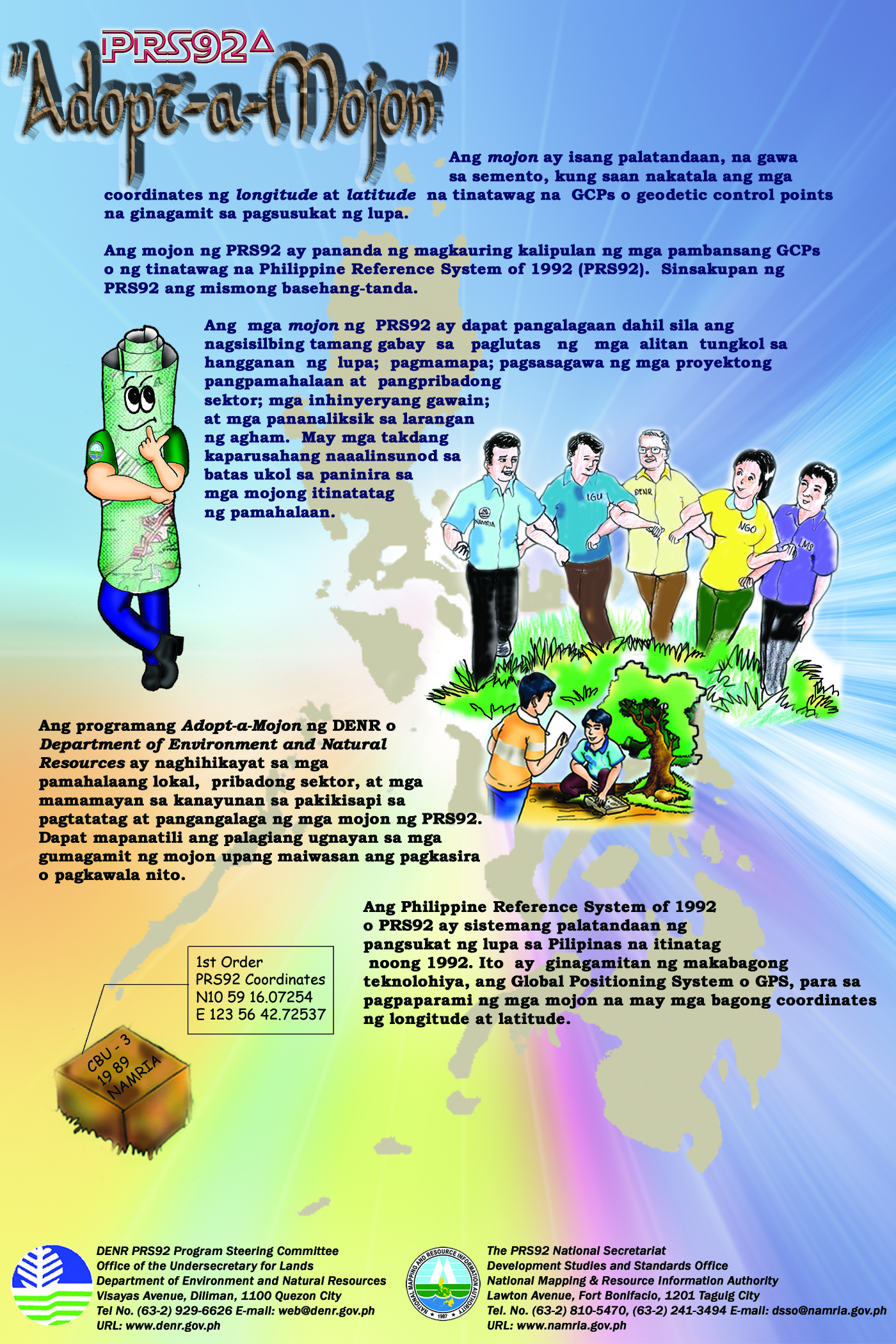
A “mojon” is a mark on land made of concrete wherein the latitude and longitude coordinates called GCPs or geodetic control points are written for land surveys use. The PRS92 or Philippine Reference System of 1992 is a homogeneous national network of these geodetic control points (GCPs).
The Adopt-a-Mojon program of DENR or Department of Environment and Natural Resources encourages local government units, private sectors and local residents to participate in the establishment and care of these “mojons”.
Download brochure and poster of Adopt-a-Mojon program.